
Motta, Wallis (2016) Harringay map of comfort zones. London School of Economics and Political Science.
![[img]](http://eprints.lse.ac.uk/69558/1/Harringay%20map%20of%20comfort%20zones_2017.png)
|
Image (PNG)
Download (2MB) | Preview |
Abstract
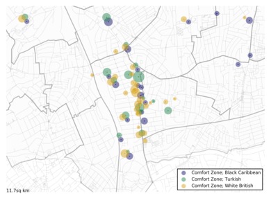
This map shows the areas that residents of Harringay feel most connected to, where they meet each other to socialise and bond together, enabling a sense of belonging to the locale. The image was produced as part of the project "Community through digital connectivity?: Communication Infrastructure in Multicultural London".
| Item Type: | Audio/visual resource |
|---|---|
| Official URL: | https://www.flickr.com/ |
| Additional Information: | © 2016 OpenStreetMap contributors and 2016 Mapzen. © CC BY-SA 2.0 |
| Divisions: | Media and Communications |
| Subjects: | G Geography. Anthropology. Recreation > GA Mathematical geography. Cartography |
| Date Deposited: | 23 Feb 2017 12:24 |
| Last Modified: | 09 May 2025 05:06 |
| URI: | http://eprints.lse.ac.uk/id/eprint/69558 |
Actions (login required)
 |
View Item |
 Download Statistics
 Download Statistics
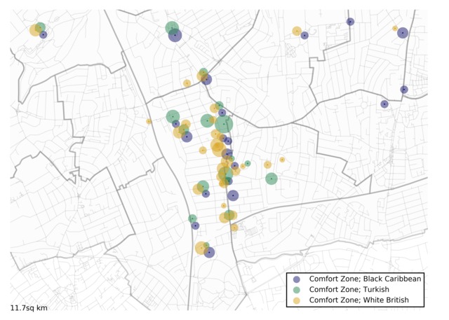