
Motta, Wallis (2016) Harringay map of hotspots. London School of Economics and Political Science.
![[img]](http://eprints.lse.ac.uk/69557/1/Harringay%20map%20of%20hotspots_2017.png)
|
Image (PNG)
Download (2MB) | Preview |
Abstract
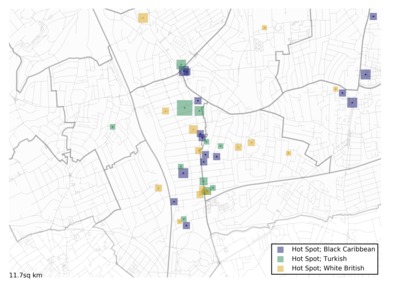
This maps shows the areas in which the residents of Harringay exchange vital information about local events and services with other neighbours. The image was produced as part of the project "Community through digital connectivity?: Communication Infrastructure in Multicultural London".
| Item Type: | Audio/visual resource |
|---|---|
| Official URL: | https://www.flickr.com/ |
| Additional Information: | © 2016 OpenStreetMap contributors and 2016 Mapzen. © CC BY-SA 2.0 |
| Divisions: | Media and Communications |
| Subjects: | G Geography. Anthropology. Recreation > GA Mathematical geography. Cartography |
| Date Deposited: | 23 Feb 2017 12:19 |
| Last Modified: | 09 May 2025 05:06 |
| URI: | http://eprints.lse.ac.uk/id/eprint/69557 |
Actions (login required)
 |
View Item |
 Download Statistics
 Download Statistics
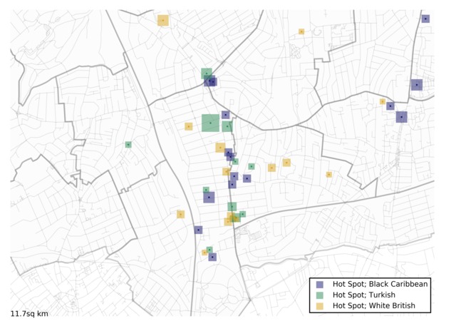